


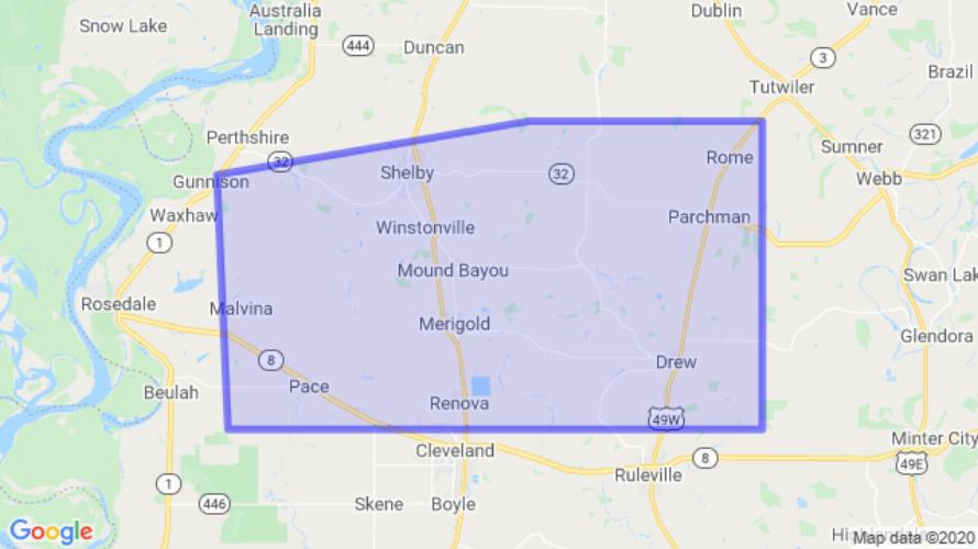
JACKSON, MS (444 PM CDT Sat Sep 12 2020) — The National Weather Service in Jackson has issued a Flash Flood Warning for Northeastern Sunflower County in northwestern Mississippi East central Bolivar County in northwestern Mississippi until 615 PM CDT. At 444 PM CDT, Doppler radar indicated thunderstorms producing heavy rain across the warned area. Up to three inches of rain have already fallen. Flash flooding is ongoing or expected to begin shortly. HAZARD: Flash flooding caused by thunderstorms. SOURCE: Radar indicated. Flooding of small creeks and streams, urban areas, highways, streets and underpasses as well as other drainage and low lying areas. Some locations that will experience flooding include Cleveland, Shelby, Drew, Parchman, Mound Bayou, Renova, Rome, Merigold, Pace and Winstonville. Turn around, don’t drown when encountering flooded roads. Most flood deaths occur in vehicles.
[sc name=”twitterfollow”]


