


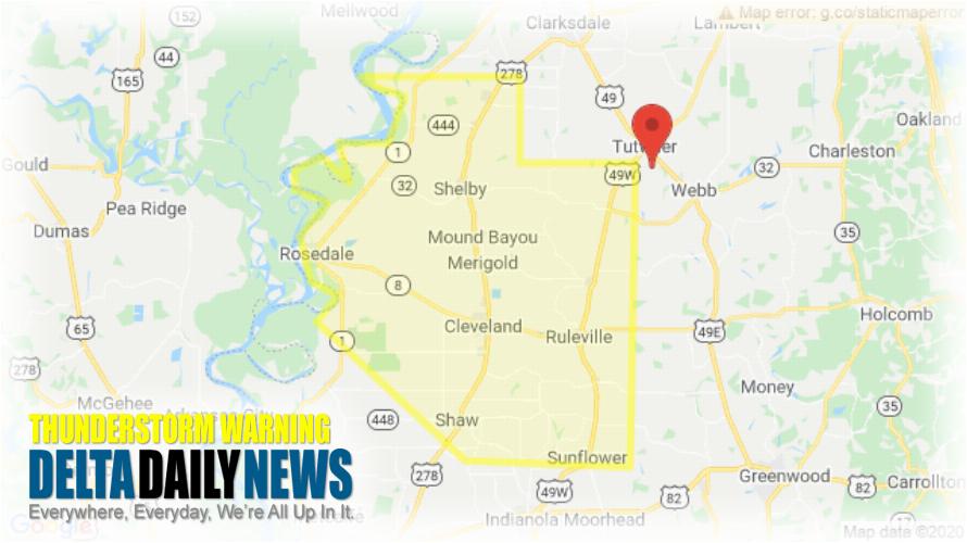
JACKSON, MS (327 PM CDT Fri Jun 5 2020) — The National Weather Service in Jackson has issued a Severe Thunderstorm Warning for Northern Sunflower County in northwestern Mississippi Bolivar County in northwestern Mississippi until 445 PM CDT. At 327 PM CDT, a severe thunderstorm was located over Tutwiler, or near Parchman, moving south at 35 mph. HAZARD: 60 mph wind gusts and quarter size hail. SOURCE: Radar indicated. Hail damage to vehicles is expected. Expect wind damage to roofs, siding, and trees. This severe thunderstorm will be near Rome around 330 PM CDT. Parchman around 335 PM CDT. Drew around 350 PM CDT. Ruleville around 400 PM CDT. Blaine around 415 PM CDT. Sunflower around 425 PM CDT. Other locations impacted by this severe thunderstorm include Alligator, Beulah, Pace, Doddsville, Winstonville, Duncan and Merigold. For your protection move to an interior room on the lowest floor of a building. Large hail and damaging winds and continuous cloud to ground lightning is occurring with this storm. Move indoors immediately. Lightning is one of nature’s leading killers. Remember, if you can hear thunder, you are close enough to be struck by lightning.
[sc name=”twitterfollow”]


