


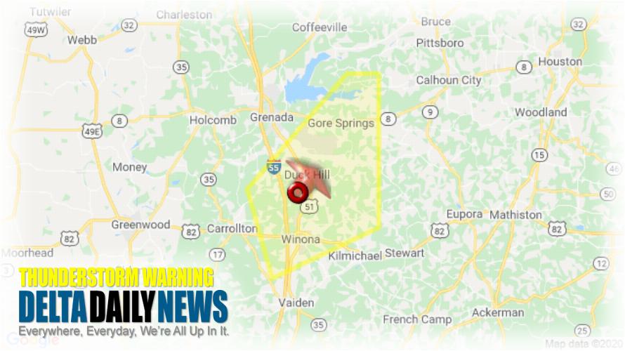
JACKSON, MS (409 PM CDT Wed May 27 2020) — The National Weather Service in Jackson has issued a Severe Thunderstorm Warning for Northeastern Carroll County in north central Mississippi Eastern Grenada County in north central Mississippi Northwestern Montgomery County in north central Mississippi until 545 PM CDT. At 409 PM CDT, a severe thunderstorm was located over Duck Hill, or 7 miles north of Winona, moving northeast at 15 mph. HAZARD: 60 mph wind gusts and quarter size hail. SOURCE: Radar indicated. Hail damage to vehicles is expected. Expect wind damage to roofs, siding, and trees. This severe thunderstorm will be near Duck Hill around 420 PM CDT. Elliott around 425 PM CDT. Sweatman around 445 PM CDT. Misterton around 500 PM CDT. Gore Springs around 505 PM CDT. For your protection move to an interior room on the lowest floor of a building.
[sc name=”twitterfollow”]


