


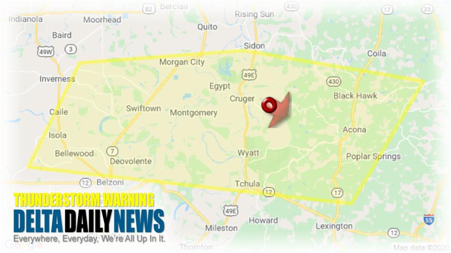
JACKSON, MS (623 PM CDT Wed Jun 3 2020) — The National Weather Service in Jackson has issued a Severe Thunderstorm Warning for Southeastern Sunflower County in northwestern Mississippi Northwestern Holmes County in central Mississippi Southwestern Carroll County in north central Mississippi Southern Leflore County in north central Mississippi Northern Humphreys County in central Mississippi until 730 PM CDT. At 623 PM CDT, a severe thunderstorm was located near Seven Pines, or 9 miles west of Black Hawk, moving southeast at 5 mph. HAZARD: Ping pong ball size hail and 60 mph wind gusts. SOURCE: Radar indicated. People and animals outdoors will be injured. Expect hail damage to roofs, siding, windows, and vehicles. Expect wind damage to roofs, siding, and trees. Locations impacted include Belzoni, Black Hawk, Tchula, Isola, Seven Pines, Swiftown, Cruger and Morgan City. For your protection move to an interior room on the lowest floor of a building.
[sc name=”twitterfollow”]


