


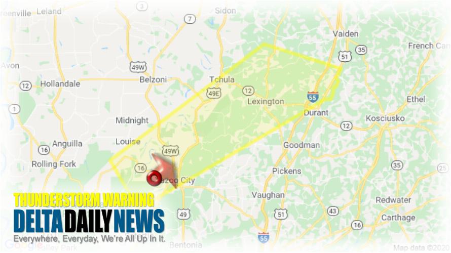
JACKSON, MS (327 PM CDT Sun Apr 12 2020) — The National Weather Service in Jackson has issued a Severe Thunderstorm Warning for Holmes County in central Mississippi Northwestern Yazoo County in central Mississippi Southeastern Humphreys County in central Mississippi until 415 PM CDT. At 327 PM CDT, a severe thunderstorm was located near Yazoo City, moving northeast at 75 mph. HAZARD: 60 mph wind gusts and quarter size hail. SOURCE: Radar indicated. Hail damage to vehicles is expected. Expect wind damage to roofs, siding, and trees. This severe thunderstorm will be near Thornton and Coxburg around 340 PM CDT. Tolarville, Brozville and Howard around 345 PM CDT. Franklin and Lexington around 350 PM CDT. Bowling Green around 355 PM CDT. Emory around 400 PM CDT. Other locations impacted by this severe thunderstorm include Eden and West. For your protection move to an interior room on the lowest floor of a building.
[sc name=”twitterfollow”]


