


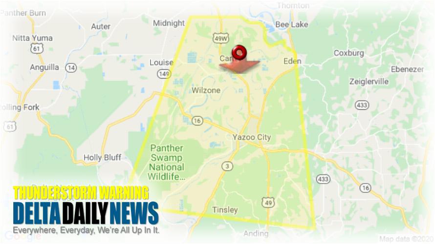
JACKSON, MS (230 PM CDT Thu Jul 2 2020) — The National Weather Service in Jackson has issued a Severe Thunderstorm Warning for Central Yazoo County in central Mississippi Southeastern Humphreys County in central Mississippi until 315 PM CDT. At 230 PM CDT, a severe thunderstorm was located 8 miles southwest of Thornton, moving south at 15 mph. HAZARD: 60 mph wind gusts and nickel size hail. SOURCE: Radar indicated. Expect damage to roofs, siding, and trees. This severe thunderstorm will be near Yazoo City around 310 PM CDT. Other locations impacted by this severe thunderstorm include Eden. For your protection move to an interior room on the lowest floor of a building. Torrential rainfall is occurring with this storm, and may lead to flash flooding. Do not drive your vehicle through flooded roadways.
[sc name=”twitterfollow”]

