


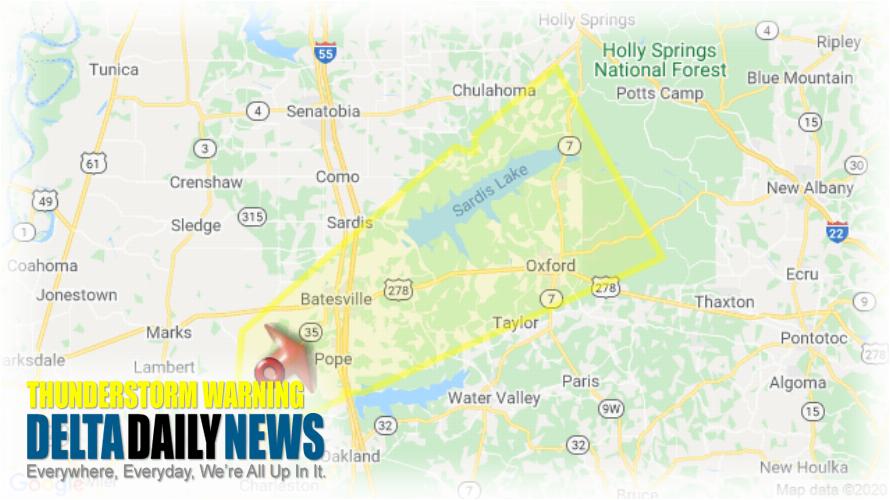
MEMPHIS, TN (957 PM CDT Sat Mar 28 2020) — The National Weather Service in Memphis has issued a Severe Thunderstorm Warning for Northern Lafayette County in northwestern Mississippi Southwestern Marshall County in northwestern Mississippi Northeastern Tallahatchie County in northwestern Mississippi Southeastern Panola County in northwestern Mississippi until 1045 PM CDT. At 956 PM CDT, a severe thunderstorm was located near Crowder, or 10 miles west of George Payne State Park, moving northeast at 60 mph. HAZARD: 60 mph wind gusts and quarter size hail. SOURCE: Radar indicated. Hail damage to vehicles is expected. Expect wind damage to roofs, siding, and trees. Locations impacted include Oxford, Batesville, Holly Springs National Forest, John W Kyle State Park, Crowder, Pope, Cambridge, Harmontown, Burgess, Laws Hill, Courtland, Abbeville, Taylor, Malone, Keel, Mims, Asa, Glenville, College Hill Station and College Hill. A Tornado Watch remains in effect until 200 AM CDT for northwestern Mississippi. A Tornado Watch remains in effect for the warned area. Tornadoes can develop quickly from severe thunderstorms. Although a tornado is not immediately likely, if one is spotted, act quickly and move to a place of safety inside a sturdy structure such as a basement or small interior room.
[sc name=”twitterfollow”]


