


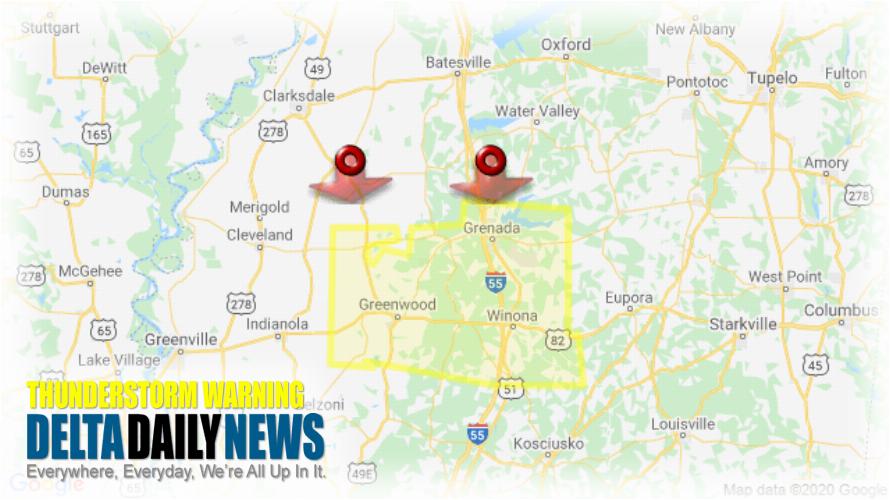
JACKSON, MS (323 PM CDT Fri Jun 5 2020) — The National Weather Service in Jackson has issued a Severe Thunderstorm Warning for Carroll County in north central Mississippi Grenada County in north central Mississippi Leflore County in north central Mississippi Montgomery County in north central Mississippi until 430 PM CDT. At 322 PM CDT, severe thunderstorms were located along a line extending from near Sumner to 8 miles northeast of Scobey, moving south at 50 mph. HAZARD: 70 mph wind gusts and quarter size hail. SOURCE: Radar indicated. Hail damage to vehicles is expected. Expect considerable tree damage. Wind damage is also likely to mobile homes, roofs, and outbuildings. Severe thunderstorms will be near Grenada, Minter City and Bew Springs around 345 PM CDT. Sunnyside around 350 PM CDT. Jefferson, Duck Hill, Elliott and Money around 355 PM CDT. Itta Bena around 405 PM CDT. Winona around 410 PM CDT. Sidon and Quito around 415 PM CDT. Vaiden around 425 PM CDT. Other locations impacted by these severe thunderstorms include Schlater, Morgan City and Carrollton. For your protection move to an interior room on the lowest floor of a building.
[sc name=”twitterfollow”]


