


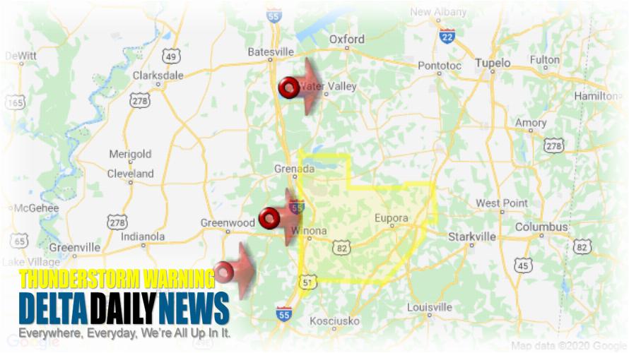
JACKSON, MS (1005 PM CDT Sun Apr 12 2020) — The National Weather Service in Jackson has issued a Severe Thunderstorm Warning for Northern Choctaw County in central Mississippi Southeastern Carroll County in north central Mississippi Eastern Grenada County in north central Mississippi Webster County in north central Mississippi Montgomery County in north central Mississippi until 1100 PM CDT. At 1004 PM CDT, severe thunderstorms were located along a line extending from near George Payne State Park to near Jefferson to near Sidon, moving east at 70 mph. HAZARD: 60 mph wind gusts. SOURCE: Radar indicated. Expect damage to roofs, siding, and trees. Severe thunderstorms will be near Winona, Duck Hill and Elliott around 1015 PM CDT. Sweatman around 1020 PM CDT. Vaiden and Lodi around 1025 PM CDT. Embry around 1030 PM CDT. Eupora, Kilmichael, Poplar Creek and Bellefontaine around 1035 PM CDT. Mathiston, Cumberland, Clarkson and Sherwood around 1045 PM CDT. Chester around 1050 PM CDT. Reform around 1055 PM CDT. Other locations impacted by these severe thunderstorms include French Camp, Mantee and Walthall. For your protection move to an interior room on the lowest floor of a building.
[sc name=”twitterfollow”]


