


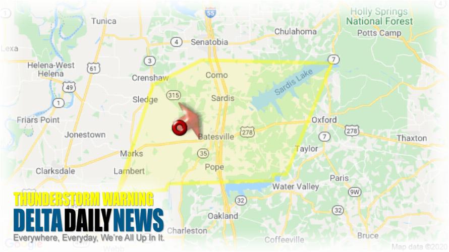
MEMPHIS, TN (816 PM CDT Sat Mar 28 2020) — The National Weather Service in Memphis has issued a Severe Thunderstorm Warning for Western Lafayette County in northwestern Mississippi Eastern Quitman County in northwestern Mississippi Panola County in northwestern Mississippi until 900 PM CDT. At 815 PM CDT, a severe thunderstorm was located near Curtis Station, or 8 miles west of Batesville, moving northeast at 60 mph. HAZARD: 60 mph wind gusts. SOURCE: Radar indicated. Expect damage to roofs, siding, and trees. Locations impacted include Batesville, John W Kyle State Park, Marks, Sardis, Lambert, Como, Crowder, Pope, Pleasant Grove, Harmontown, Curtis Station, Burgess, Courtland, Abbeville, Mims, Denton, Asa, Glenville, College Hill and Hayes Crossing. A Tornado Watch remains in effect until 200 AM CDT for northwestern Mississippi. For your protection move to an interior room on the lowest floor of a building.
[sc name=”twitterfollow”]


