


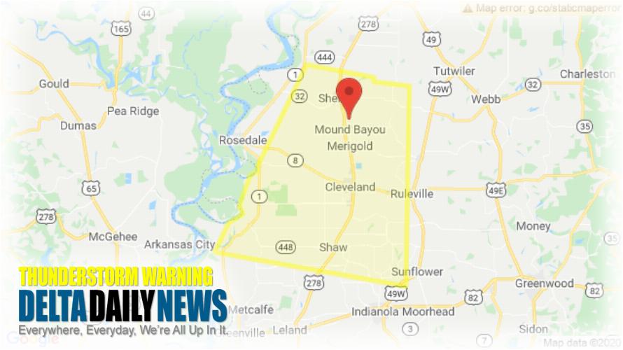
JACKSON, MS (819 PM CDT Thu Jul 2 2020) — The National Weather Service in Jackson has issued a Severe Thunderstorm Warning for Central Sunflower County in northwestern Mississippi Bolivar County in northwestern Mississippi until 900 PM CDT. At 819 PM CDT, a severe thunderstorm was located over Mound Bayou, or near Shelby, moving south at 30 mph. HAZARD: 60 mph wind gusts and penny size hail. SOURCE: Radar indicated. Expect damage to roofs, siding, and trees. This severe thunderstorm will be near Renova around 835 PM CDT. Cleveland and Boyle around 845 PM CDT. Shaw around 900 PM CDT. Other locations impacted by this severe thunderstorm include Winstonville, Beulah, Pace and Merigold. For your protection move to an interior room on the lowest floor of a building.
[sc name=”twitterfollow”]


