


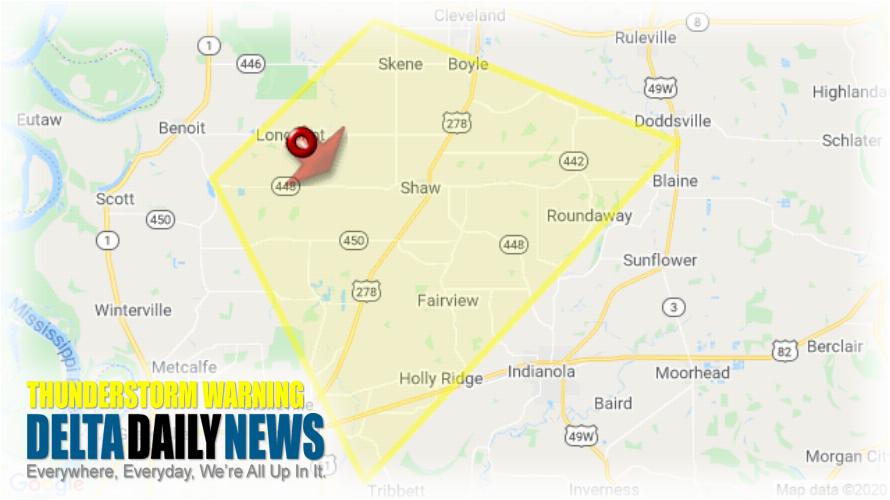
JACKSON, MS (930 PM CDT Tue Mar 24 2020) — The National Weather Service in Jackson has issued a Severe Thunderstorm Warning for Central Sunflower County in northwestern Mississippi Northeastern Washington County in northwestern Mississippi Southeastern Bolivar County in northwestern Mississippi until 1015 PM CDT. At 930 PM CDT, a severe thunderstorm was located 7 miles west of Shaw, moving southeast at 25 mph. HAZARD: 60 mph wind gusts and quarter size hail. SOURCE: Radar indicated. Hail damage to vehicles is expected. Expect wind damage to roofs, siding, and trees. This severe thunderstorm will be near Shaw around 945 PM CDT. Holly Ridge around 1010 PM CDT. For your protection move to an interior room on the lowest floor of a building.
[sc name=”twitterfollow”]


