


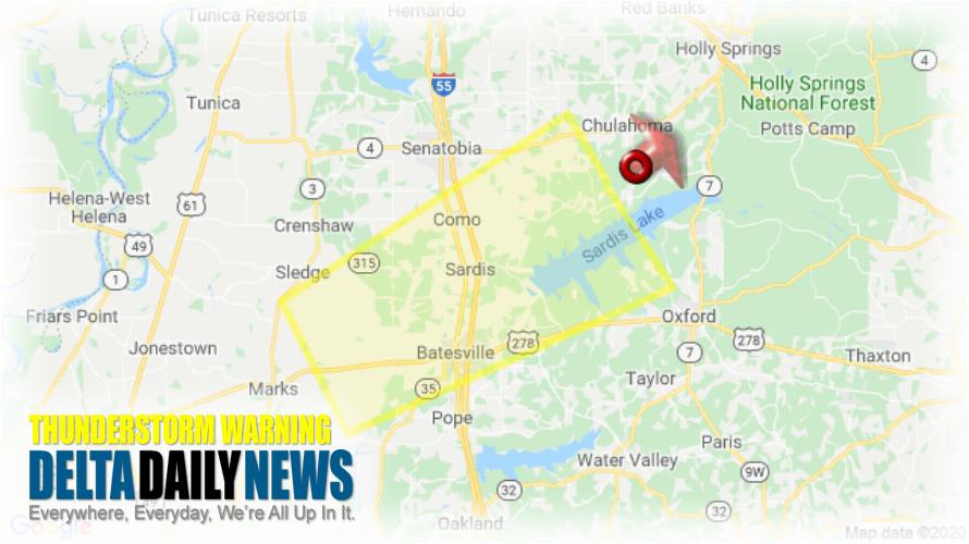
MEMPHIS, TN (534 AM CST Sat Jan 11 2020) — The National Weather Service in Memphis has issued a Severe Thunderstorm Warning for Northwestern Lafayette County in northwestern Mississippi Southeastern Tate County in northwestern Mississippi Northeastern Quitman County in northwestern Mississippi Panola County in northwestern Mississippi until 615 AM CST. At 533 AM CST, a severe thunderstorm was located over Laws Hill, or 8 miles southwest of Wall Doxey State Park, moving northeast at 50 mph. HAZARD: 60 mph wind gusts. SOURCE: Radar indicated. Expect damage to roofs, siding, and trees. Locations impacted include Batesville, John W Kyle State Park, Sardis, Como, Barr, Pleasant Grove, Harmontown, Curtis Station, Falcon, Mims, Aiken, Crossroad, Tyro, Asa, Glenville, College Hill, Hayes Crossing, Horatio, Teckville and Looxahoma. A Tornado Watch remains in effect until 700 AM CST for northwestern Mississippi. A Tornado Watch also remains in effect until 1000 AM CST for northwestern Mississippi. For your protection move to an interior room on the lowest floor of a building. Torrential rainfall is occurring with this storm, and may lead to flash flooding. Do not drive your vehicle through flooded roadways.
[sc name=”twitterfollow”]

