


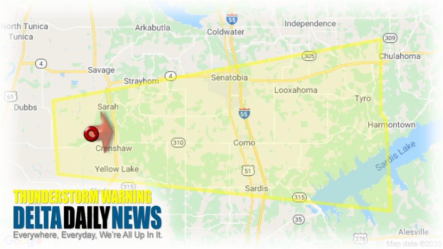
MEMPHIS, TN (1104 PM CDT Sun Mar 22 2020) — The National Weather Service in Memphis has issued a Severe Thunderstorm Warning for Northwestern Lafayette County in northwestern Mississippi Southeastern Tunica County in northwestern Mississippi Southern Tate County in northwestern Mississippi North central Quitman County in northwestern Mississippi Northern Panola County in northwestern Mississippi until 1145 PM CDT. At 1103 PM CDT, a severe thunderstorm was located near Crenshaw, or 16 miles west of Senatobia, moving east at 45 mph. HAZARD: Quarter size hail. SOURCE: Radar indicated. Damage to vehicles is expected. Locations impacted include Senatobia, John W Kyle State Park, Sardis, Como, Crenshaw, Barr, Askew, Buxton, Aiken, Tyro, Crossroad, Glenville, Sarah, Hayes Crossing, Cypress Corner, Bluff, Teckville, Looxahoma, Wyatte and McGhee. For your protection move to an interior room on the lowest floor of a building.
[sc name=”twitterfollow”]

