


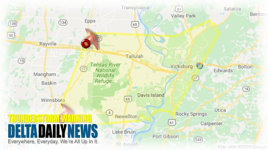
JACKSON, MS (510 AM CST Sat Jan 11 2020) — The National Weather Service in Jackson has issued a Severe Thunderstorm Warning for Northern Tensas Parish in northeastern Louisiana Madison Parish in northeastern Louisiana Eastern Richland Parish in northeastern Louisiana Northeastern Franklin Parish in northeastern Louisiana Warren County in west central Mississippi Southeastern Issaquena County in west central Mississippi until 615 AM CST. At 508 AM CST, severe thunderstorms were located along a line extending from near Delhi to near Jigger, moving northeast at 70 mph. HAZARD: 60 mph wind gusts and quarter size hail. SOURCE: Radar indicated. Hail damage to vehicles is expected. Expect wind damage to roofs, siding, and trees. Severe thunderstorms will be near Waverly and Tendal around 515 AM CST. Somerset around 530 AM CST. Afton around 535 AM CST. Tallulah around 540 AM CST. Redwood around 555 AM CST. Oak Ridge around 600 AM CST. Other locations impacted by these severe thunderstorms include Mound, Gilbert, Delta and Richmond. For your protection move to an interior room on the lowest floor of a building.
[sc name=”twitterfollow”]

