


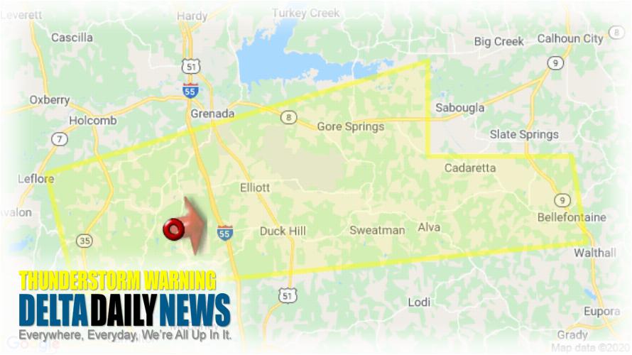
JACKSON, MS (210 AM CDT Mon Mar 23 2020) — The National Weather Service in Jackson has issued a Severe Thunderstorm Warning for North central Carroll County in north central Mississippi Southeastern Grenada County in north central Mississippi Northwestern Webster County in north central Mississippi Northwestern Montgomery County in north central Mississippi until 300 AM CDT. At 209 AM CDT, a severe thunderstorm was located over Jefferson, or 9 miles south of Grenada, moving east at 50 mph. HAZARD: 60 mph wind gusts and quarter size hail. SOURCE: Radar indicated. Hail damage to vehicles is expected. Expect wind damage to roofs, siding, and trees. This severe thunderstorm will be near Elliott around 215 AM CDT. Duck Hill around 220 AM CDT. Gore Springs around 225 AM CDT. Misterton and Sweatman around 230 AM CDT. Embry around 240 AM CDT. Bellefontaine around 245 AM CDT. For your protection move to an interior room on the lowest floor of a building.
[sc name=”twitterfollow”]

