


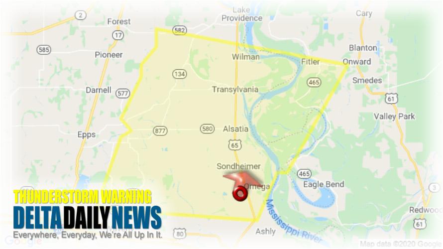
JACKSON, MS (510 PM CDT Thu May 14 2020) — The National Weather Service in Jackson has issued a Severe Thunderstorm Warning for Southern East Carroll Parish in northeastern Louisiana Northwestern Madison Parish in northeastern Louisiana West central Issaquena County in west central Mississippi until 600 PM CDT. At 510 PM CDT, a severe thunderstorm was located over Omega, or 7 miles north of Tallulah, moving north at 25 mph. HAZARD: 60 mph wind gusts and quarter size hail. SOURCE: Radar indicated. Hail damage to vehicles is expected. Expect wind damage to roofs, siding, and trees. This severe thunderstorm will be near Sondheimer around 515 PM CDT. Alsatia around 525 PM CDT. Transylvania around 535 PM CDT. Fitler around 550 PM CDT. For your protection move to an interior room on the lowest floor of a building.
[sc name=”twitterfollow”]


