


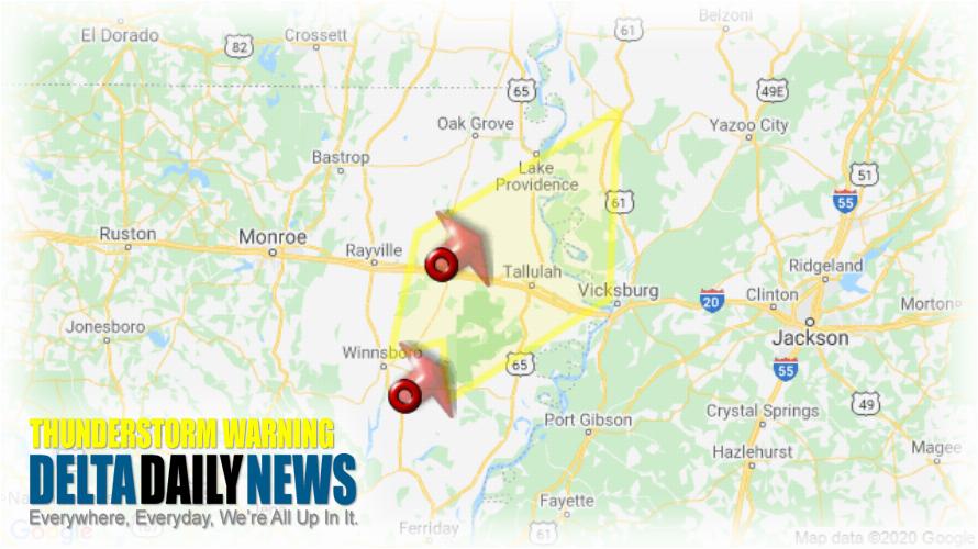
JACKSON, MS (449 PM CDT Sun Apr 12 2020) — The National Weather Service in Jackson has issued a Severe Thunderstorm Warning for Southern East Carroll Parish in northeastern Louisiana Northwestern Tensas Parish in northeastern Louisiana Madison Parish in northeastern Louisiana Northeastern Richland Parish in northeastern Louisiana South central West Carroll Parish in northeastern Louisiana Northeastern Franklin Parish in northeastern Louisiana Northwestern Warren County in west central Mississippi Central Issaquena County in west central Mississippi Southwestern Sharkey County in west central Mississippi until 530 PM CDT. At 448 PM CDT, severe thunderstorms were located along a line extending from near Delhi to 7 miles southeast of Winnsboro, moving northeast at 80 mph. HAZARD: 60 mph wind gusts and quarter size hail. SOURCE: Radar indicated. Hail damage to vehicles is expected. Expect wind damage to roofs, siding, and trees. Severe thunderstorms will be near Monticello, Warden and Waverly around 455 PM CDT. Sondheimer around 500 PM CDT. Transylvania and Alsatia around 505 PM CDT. Fitler and Afton around 510 PM CDT. Tallulah, Onward and Mansford around 515 PM CDT. Eagle Bend around 525 PM CDT. Other locations impacted by these severe thunderstorms include Mound, Cary, Richmond and Epps. For your protection move to an interior room on the lowest floor of a building.
[sc name=”twitterfollow”]


