


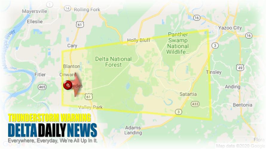
JACKSON, MS (131 AM CST Wed Mar 4 2020) — The National Weather Service in Jackson has issued a Severe Thunderstorm Warning for Southwestern Yazoo County in central Mississippi East central Issaquena County in west central Mississippi Southern Sharkey County in west central Mississippi until 215 AM CST. At 131 AM CST, a severe thunderstorm was located over Onward, or near Valley Park, moving east at 40 mph. HAZARD: 60 mph wind gusts and half dollar size hail. SOURCE: Radar indicated. Hail damage to vehicles is expected. Expect wind damage to roofs, siding, and trees. This severe thunderstorm will be near Valley Park around 140 AM CST. Holly Bluff around 150 AM CST. Other locations impacted by this severe thunderstorm include Satartia. For your protection move to an interior room on the lowest floor of a building.
[sc name=”twitterfollow”]


