


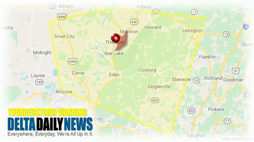
JACKSON, MS (714 PM CDT Wed Jun 3 2020) — The National Weather Service in Jackson has issued a Severe Thunderstorm Warning for Southwestern Holmes County in central Mississippi Northeastern Yazoo County in central Mississippi Southeastern Humphreys County in central Mississippi until 815 PM CDT. At 713 PM CDT, a severe thunderstorm was located over Thornton, moving southeast at 20 mph. HAZARD: 60 mph wind gusts and quarter size hail. SOURCE: Radar indicated. Hail damage to vehicles is expected. Expect wind damage to roofs, siding, and trees. This severe thunderstorm will be near Howard around 730 PM CDT. Tolarville around 735 PM CDT. Coxburg around 740 PM CDT. Brozville around 750 PM CDT. Ebenezer around 800 PM CDT. Other locations impacted by this severe thunderstorm include Eden and Silver City. For your protection move to an interior room on the lowest floor of a building.
[sc name=”twitterfollow”]


