


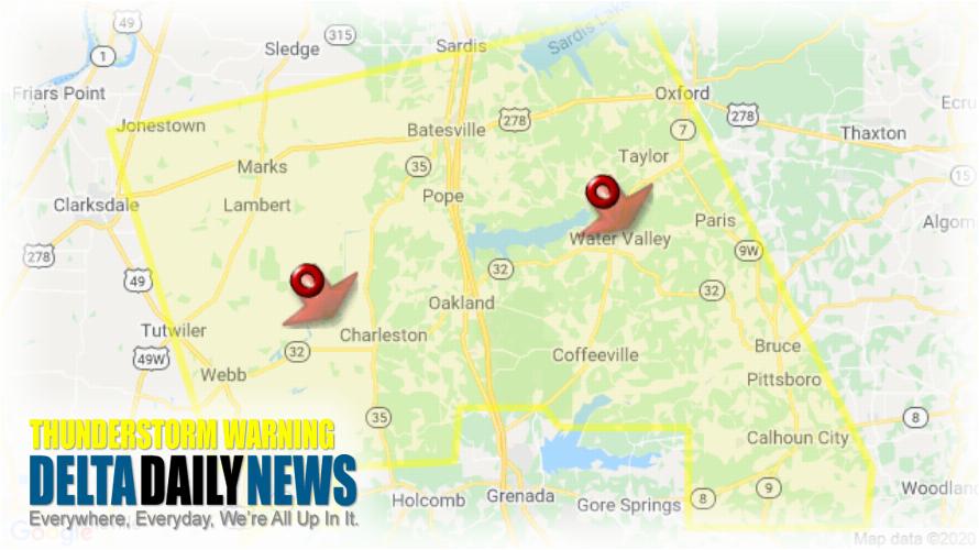
MEMPHIS, TN (314 PM CDT Fri Jun 5 2020) — The National Weather Service in Memphis has issued a Severe Thunderstorm Warning for Western Lafayette County in northwestern Mississippi Yalobusha County in northwestern Mississippi East central Coahoma County in northwestern Mississippi Calhoun County in northeastern Mississippi Tallahatchie County in northwestern Mississippi Quitman County in northwestern Mississippi Panola County in northwestern Mississippi until 400 PM CDT. At 311 PM CDT, severe thunderstorms were located along a line extending from near Springdale to 6 miles east of Vance, moving southeast at 45 mph. HAZARD: 60 mph wind gusts. SOURCE: Radar indicated. Expect damage to roofs, siding, and trees. Locations impacted include Oxford, Batesville, Water Valley, Charleston, George Payne State Park, Holly Springs National Forest, John W Kyle State Park, Tutwiler, Bruce, Calhoun City, Marks, Sardis, Lambert, Jonestown, Derma, Coffeeville, Crowder, Webb, Sumner and Pope. For your protection move to an interior room on the lowest floor of a building.
[sc name=”twitterfollow”]


