


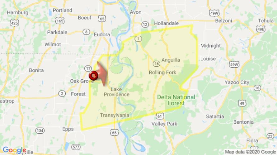
JACKSON, MS (232 PM CDT Fri Jul 31 2020) — The National Weather Service in Jackson has issued a Severe Thunderstorm Warning for East Carroll Parish in northeastern Louisiana Southeastern Washington County in northwestern Mississippi Northwestern Issaquena County in west central Mississippi Sharkey County in west central Mississippi until 330 PM CDT. At 232 PM CDT, a severe thunderstorm was located near Shelburn, or 9 miles northwest of Lake Providence, moving east at 50 mph. HAZARD: Ping pong ball size hail and 60 mph wind gusts. SOURCE: Radar indicated. People and animals outdoors will be injured. Expect hail damage to roofs, siding, windows, and vehicles. Expect wind damage to roofs, siding, and trees. This severe thunderstorm will be near Glen Allan around 255 PM CDT. Rolling Fork and Grace around 300 PM CDT. Anguilla, Nitta Yuma and Panther Burn around 305 PM CDT. Delta City around 310 PM CDT. Murphy around 320 PM CDT. Other locations impacted by this severe thunderstorm include Mayersville and Cary. For your protection move to an interior room on the lowest floor of a building.
[sc name=”twitterfollow”]

