


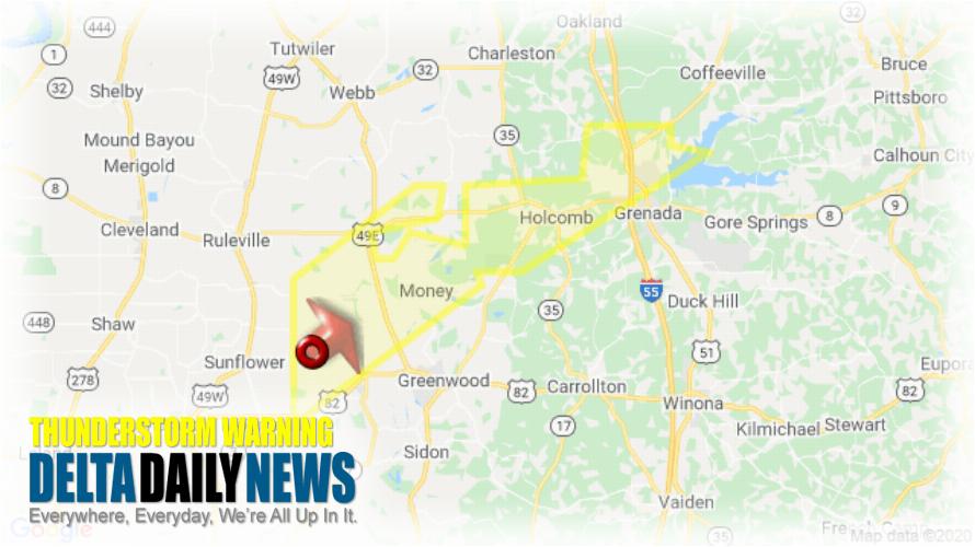
JACKSON, MS (1149 PM CDT Wed Apr 22 2020) — The National Weather Service in Jackson has issued a Severe Thunderstorm Warning for Western Grenada County in north central Mississippi Northern Leflore County in north central Mississippi until 1230 AM CDT. At 1149 PM CDT, a severe thunderstorm was located near Itta Bena, moving northeast at 85 mph. HAZARD: Quarter size hail. SOURCE: Radar indicated. Damage to vehicles is expected. This severe thunderstorm will be near Money, Sunnyside and Minter City around 1200 AM CDT. Leflore around 1205 AM CDT. Holcomb around 1210 AM CDT. Grenada and Bew Springs around 1215 AM CDT. Other locations impacted by this severe thunderstorm include Schlater. For your protection move to an interior room on the lowest floor of a building.
[sc name=”twitterfollow”]


