


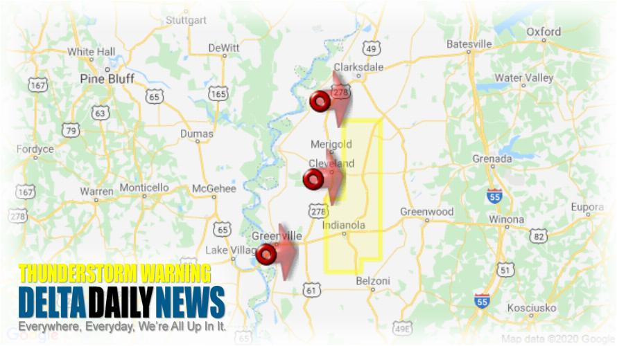
JACKSON, MS (922 PM CDT Sun Apr 12 2020) — The National Weather Service in Jackson has issued a Severe Thunderstorm Warning for Sunflower County in northwestern Mississippi until 1015 PM CDT. At 922 PM CDT, severe thunderstorms were located along a line extending from 6 miles northeast of Deeson to near Cleveland to near Greenville, moving east at 55 mph. HAZARD: 60 mph wind gusts. SOURCE: Radar indicated. Expect damage to roofs, siding, and trees. Severe thunderstorms will be near Ruleville and Drew around 940 PM CDT. Holly Ridge around 945 PM CDT. Indianola and Inverness around 950 PM CDT. Moorhead around 1000 PM CDT. Other locations impacted by these severe thunderstorms include Doddsville. For your protection move to an interior room on the lowest floor of a building.
[sc name=”twitterfollow”]


