


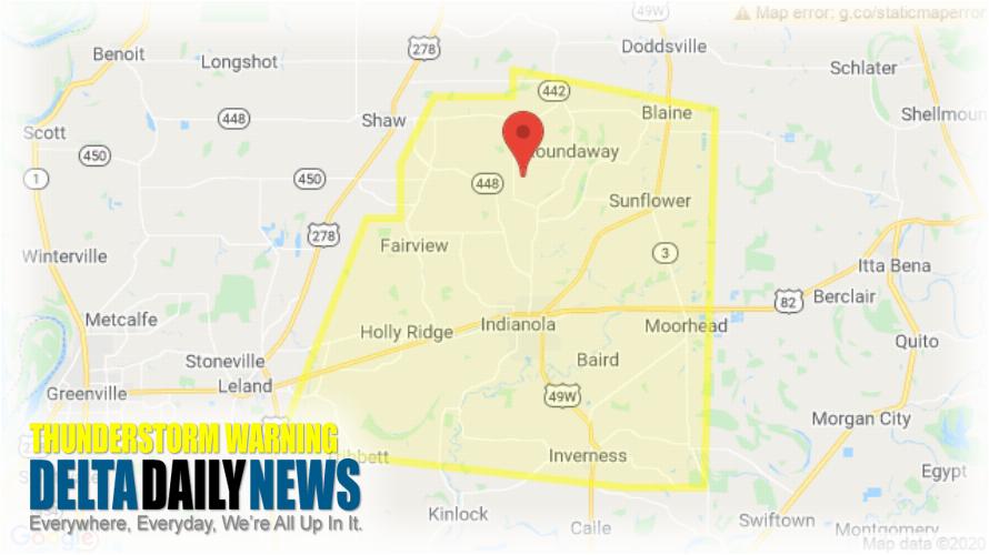
JACKSON, MS (308 PM CDT Thu Jul 2 2020) — The National Weather Service in Jackson has issued a Severe Thunderstorm Warning for Southern Sunflower County in northwestern Mississippi Northeastern Washington County in northwestern Mississippi until 345 PM CDT. At 307 PM CDT, a severe thunderstorm was located near Sunflower, or 7 miles north of Indianola, moving south at 20 mph. HAZARD: 60 mph wind gusts and penny size hail. SOURCE: Radar indicated. Expect damage to roofs, siding, and trees. This severe thunderstorm will be near Indianola around 330 PM CDT. Holly Ridge around 340 PM CDT. Inverness around 345 PM CDT. For your protection move to an interior room on the lowest floor of a building.
[sc name=”twitterfollow”]


