


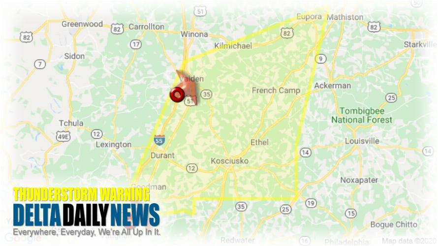
JACKSON, MS (718 AM CST Sat Jan 11 2020) — The National Weather Service in Jackson has issued a Severe Thunderstorm Warning for Western Choctaw County in central Mississippi Southeastern Holmes County in central Mississippi Southeastern Carroll County in north central Mississippi Attala County in central Mississippi Southwestern Webster County in north central Mississippi Southern Montgomery County in north central Mississippi until 815 AM CST. At 718 AM CST, severe thunderstorms were located along a line extending from near Vaiden to near Pickens, moving northeast at 60 mph. HAZARD: 60 mph wind gusts. SOURCE: Radar indicated. Expect damage to roofs, siding, and trees. Severe thunderstorms will be near Vaiden around 725 AM CST. Kilmichael and Poplar Creek around 735 AM CST. Mcadams around 740 AM CST. Kosciusko around 745 AM CST. Smyrna around 750 AM CST. Eupora around 755 AM CST. Other locations impacted by these severe thunderstorms include Mccool, Ethel, Sallis, French Camp, West and Weir. For your protection move to an interior room on the lowest floor of a building.
[sc name=”twitterfollow”]


