


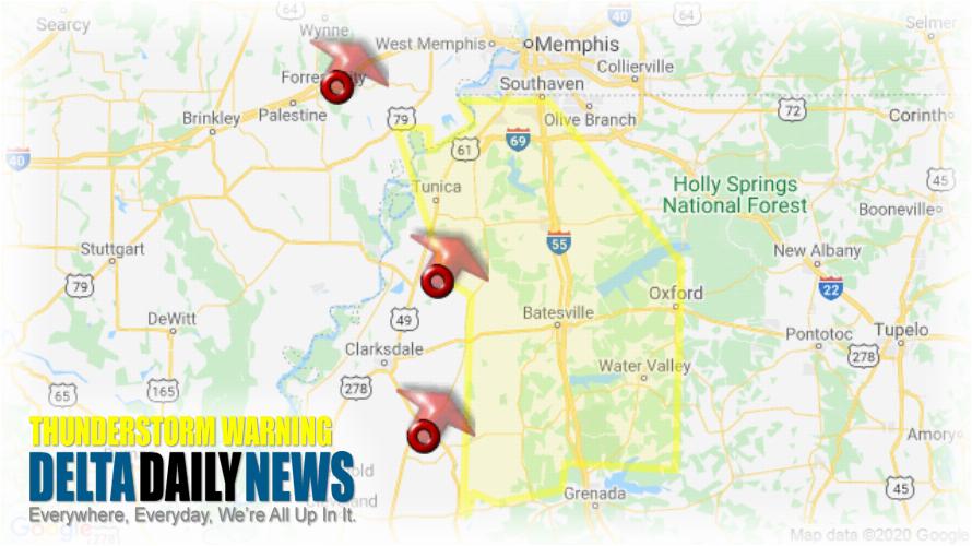
MEMPHIS, TN (950 PM CDT Sun Apr 12 2020) — The National Weather Service in Memphis has issued a Severe Thunderstorm Warning for Northeastern Lee County in eastern Arkansas Western Lafayette County in northwestern Mississippi DeSoto County in northwestern Mississippi Yalobusha County in northwestern Mississippi Southwestern Marshall County in northwestern Mississippi Tunica County in northwestern Mississippi Tate County in northwestern Mississippi Tallahatchie County in northwestern Mississippi Eastern Quitman County in northwestern Mississippi Panola County in northwestern Mississippi until 1045 PM CDT. At 950 PM CDT, severe thunderstorms were located along a line extending from Madison to 6 miles southeast of Dundee to Tutwiler, moving northeast at 70 mph. HAZARD: 70 mph wind gusts. SOURCE: Radar indicated. Expect considerable tree damage. Damage is likely to mobile homes, roofs, and outbuildings. Locations impacted include Southaven, Horn Lake, Oxford, Hernando, Senatobia, Batesville, Water Valley, Charleston, George Payne State Park, Holly Springs National Forest, John W Kyle State Park, Marks, Sardis, Coldwater, Como, Walls, Tunica, Coffeeville, Crenshaw and Crowder. For your protection move to an interior room on the lowest floor of a building. Large hail and damaging winds and continuous cloud to ground lightning is occurring with these storms. Move indoors immediately. Lightning is one of nature’s leading killers. Remember, if you can hear thunder, you are close enough to be struck by lightning.
[sc name=”twitterfollow”]


