





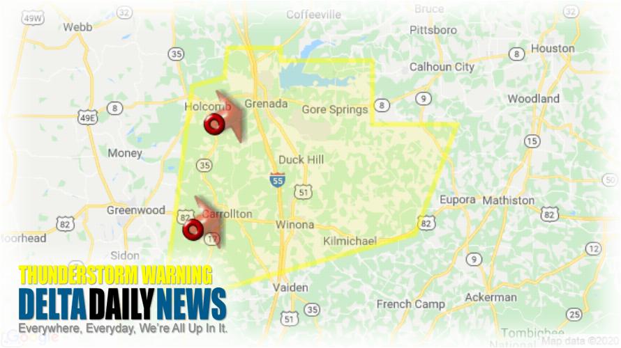
JACKSON, MS (514 AM CST Sat Jan 11 2020) — The National Weather Service in Jackson has issued a Severe Thunderstorm Warning for Carroll County in north central Mississippi Grenada County in north central Mississippi Western Webster County in north central Mississippi Montgomery County in north central Mississippi until 615 AM CST. At 513 AM CST, severe thunderstorms were located along a line extending from near Holcomb to near Malmaison, moving east at 55 mph. HAZARD: 60 mph wind gusts. SOURCE: Radar indicated. Expect damage to roofs, siding, and trees. Severe thunderstorms will be near Grenada and Bew Springs around 520 AM CST. Jefferson and Elliott around 525 AM CST. Winona around 530 AM CST. Duck Hill and Gore Springs around 535 AM CST. Sweatman, Misterton and Lodi around 545 AM CST. Embry around 555 AM CST. Bellefontaine around 600 AM CST. Other locations impacted by these severe thunderstorms include Carrollton. For your protection move to an interior room on the lowest floor of a building.
[sc name=”twitterfollow”]You Might Also Like These...
Latest Local News
Entergy Mississippi to Receive $4.2 million Federal Grant for Transmission Upgrades
JACKSON, Miss. — Entergy Mississippi has been selected to... Read More.
Delta State to Open Okra Threads Clothing Closet Oct. 22
CLEVELAND, Miss. — Delta State University will celebrate the... Read More.
Bolivar County Regional Correctional Facility Hiring for Multiple Positions
CLEVELAND, Miss. — The Bolivar County Regional Correctional Facility... Read More.
Mississippi House Speaker Releases Statewide Poll on Voter Concerns
JACKSON, Miss. — Mississippi House Speaker Jason White has... Read More.
Previous
Next
Current Weather

As of 2:30 pm
79°Clear
- Humidity
- 21%
- Dew point
- 36°
- Wind
- NE 6 mph
- Visibility
- 10 mi
- Pressure
- 30.23 in
- TodayHigh 79° 0% chance of rain
- TonightLow 50° 0% chance of rain
- WedHigh 81° 1% chance of rain
- Wed NightLow 52° 0% chance of rain
- ThuHigh 81° 0% chance of rain