





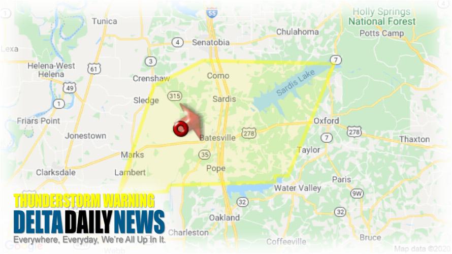
MEMPHIS, TN (816 PM CDT Sat Mar 28 2020) — The National Weather Service in Memphis has issued a Severe Thunderstorm Warning for Western Lafayette County in northwestern Mississippi Eastern Quitman County in northwestern Mississippi Panola County in northwestern Mississippi until 900 PM CDT. At 815 PM CDT, a severe thunderstorm was located near Curtis Station, or 8 miles west of Batesville, moving northeast at 60 mph. HAZARD: 60 mph wind gusts. SOURCE: Radar indicated. Expect damage to roofs, siding, and trees. Locations impacted include Batesville, John W Kyle State Park, Marks, Sardis, Lambert, Como, Crowder, Pope, Pleasant Grove, Harmontown, Curtis Station, Burgess, Courtland, Abbeville, Mims, Denton, Asa, Glenville, College Hill and Hayes Crossing. A Tornado Watch remains in effect until 200 AM CDT for northwestern Mississippi. For your protection move to an interior room on the lowest floor of a building.
[sc name=”twitterfollow”]You Might Also Like These...
Latest Local News
Entergy Mississippi to Receive $4.2 million Federal Grant for Transmission Upgrades
JACKSON, Miss. — Entergy Mississippi has been selected to... Read More.
Delta State to Open Okra Threads Clothing Closet Oct. 22
CLEVELAND, Miss. — Delta State University will celebrate the... Read More.
Bolivar County Regional Correctional Facility Hiring for Multiple Positions
CLEVELAND, Miss. — The Bolivar County Regional Correctional Facility... Read More.
Mississippi House Speaker Releases Statewide Poll on Voter Concerns
JACKSON, Miss. — Mississippi House Speaker Jason White has... Read More.
Previous
Next
Current Weather

As of 4:20 pm
79°Clear
- Humidity
- 21%
- Dew point
- 36°
- Wind
- NE 14 mph
- Visibility
- 10 mi
- Pressure
- 30.20 in
- TonightLow 50° 0% chance of rain
- WedHigh 81° 1% chance of rain
- Wed NightLow 52° 0% chance of rain
- ThuHigh 81° 0% chance of rain
- Thu NightLow 54° 0% chance of rain